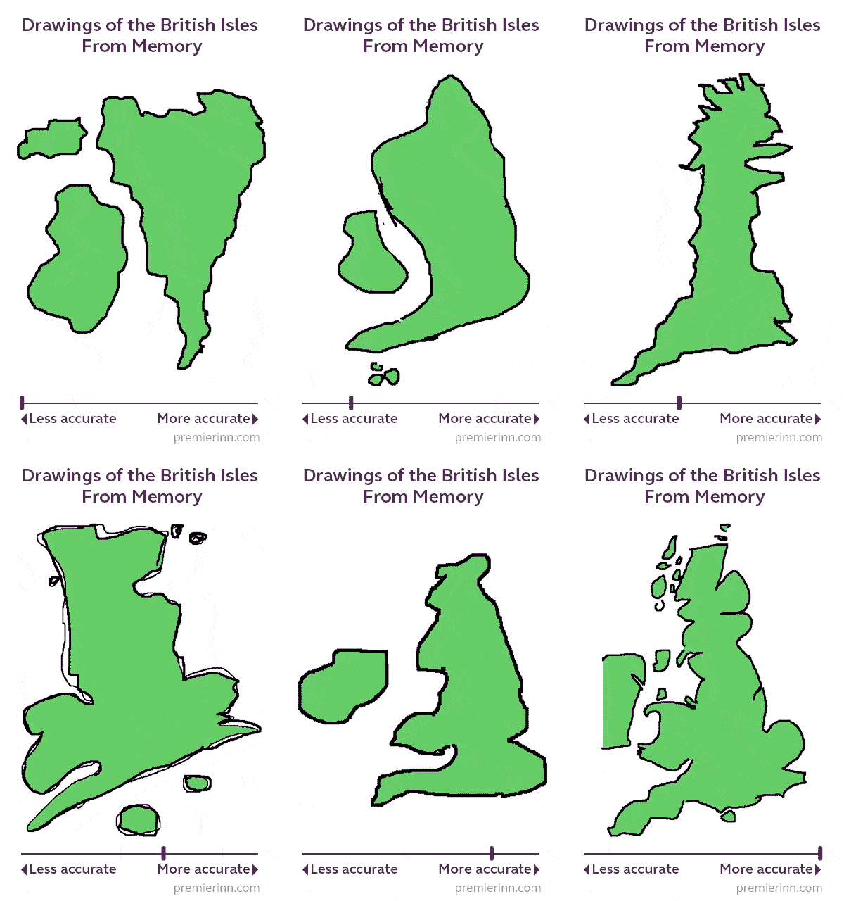
- When asked to draw the British Isles from memory, 2 in 3 forgot at least one nation
- We combined drawings of the British Isles using artificial intelligence to create one definitive map as remembered by Brits
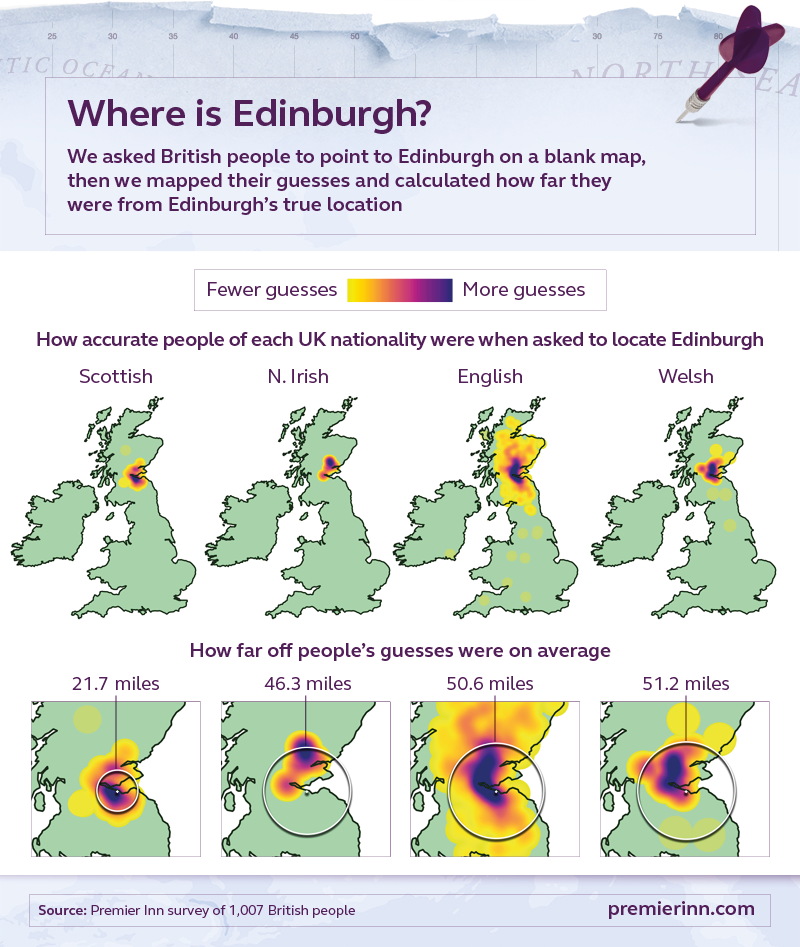
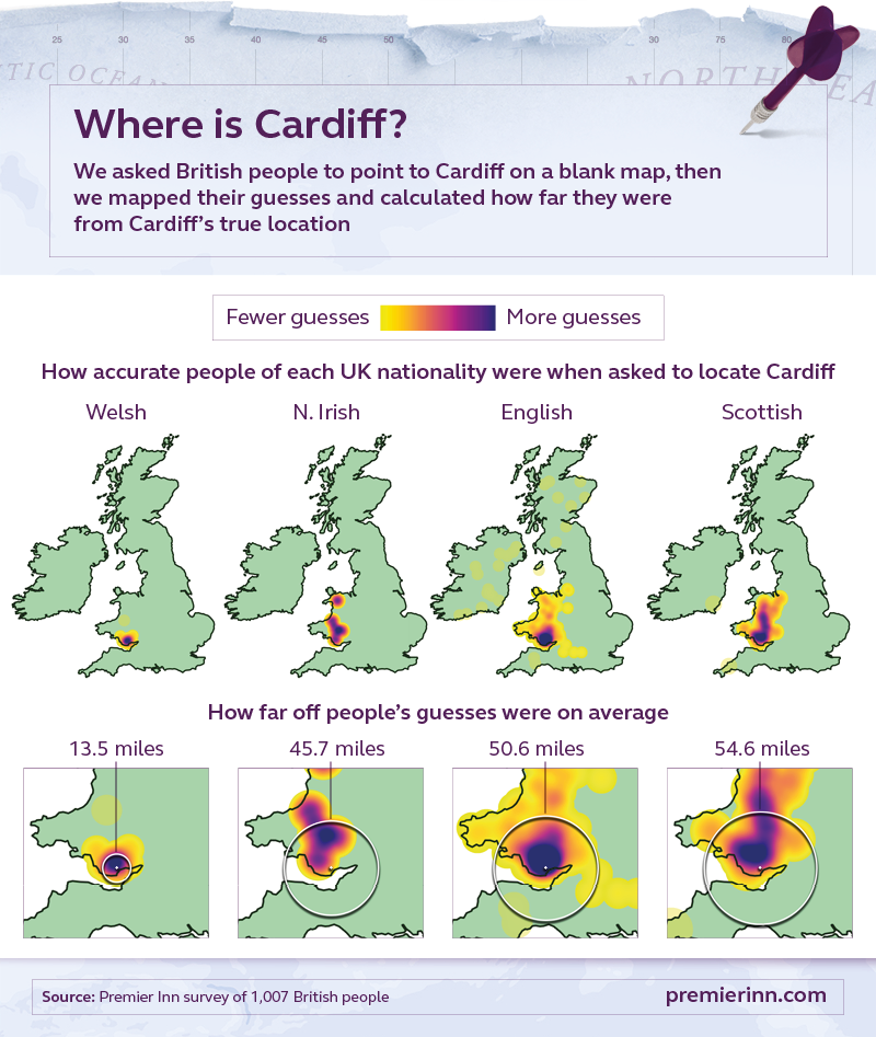
- Northern Irish people located their own capital on a blank map more accurately than other nationalities (11.6 miles off on average)
- English people were the only nationality who couldn’t locate their own capital more accurately than everyone else – the Welsh were better
- 1 in 5 non-Northern Irish people incorrectly placed Belfast in the Republic of Ireland, while 1 in 10 non-Welsh people put Cardiff in England
- When placing their hometown on a blank map, half placed it in the wrong county and 28% put it in the wrong region
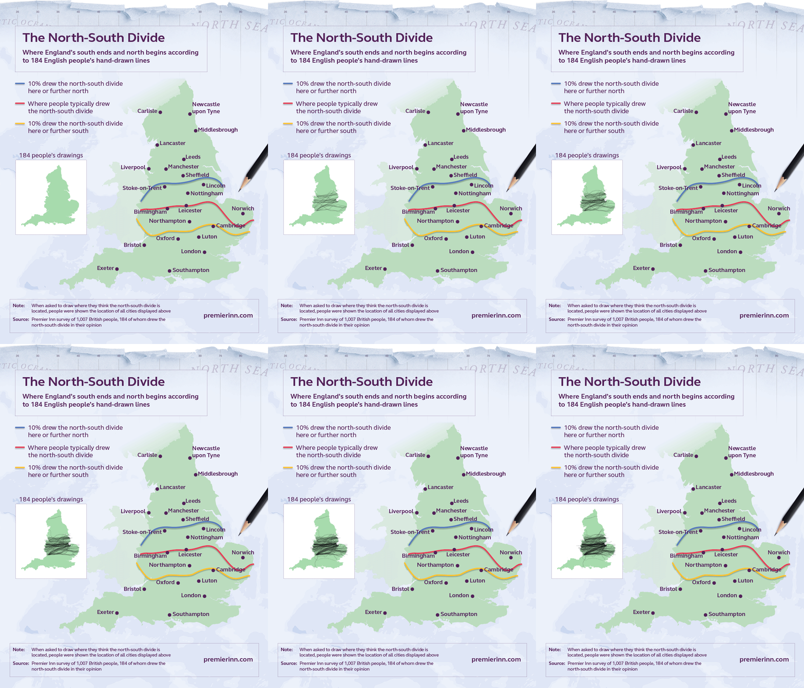
- We combined more than 180 people’s hand-drawn north-south border lines and found the English south ends at Birmingham and the north begins at Leicester
- 10% of hand-drawn north-south borders laid no farther north than Cambridge, while another 10% sat no farther south than Stoke-on-Trent
Much of life is knowing where we are and where we’re going. Some manage it better than others. Britain’s national bird, the robin, navigates using the Earth’s magnetic field1, while dung beetles map their whereabouts by memorising the positions of stars2. How well can we map our home country or locate our hometown? Is our mind’s eye akin to satellite navigation or a geographical Etch-A-Sketch?
To find out, we surveyed 1,007 British people and asked them to draw a map of the British Isles, locate major UK cities and their hometown, and draw England’s most contentious boundary – the north-south divide. The results reveal our perception, knowledge and opinions of British geography.


